Welcome to my maps of East Frisia pages, probably the largest Internet-source
The main aspect of these pages is naturally represented by the descriptions of some important maps
and esspecially all the photos belonging to them, on which the small pieces of art can be seen.
For those who are interested I also have a
for historical maps of East Frisia.
So please visit the small but fine virtual map exposition!
short summary of the history of the maps of East Frisia.

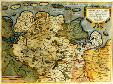
"FRISIAE ORIENTALIS / nova et exacta descriptio / [...]", |
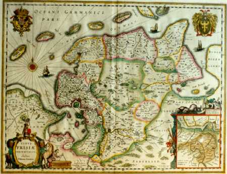
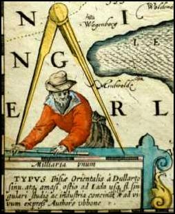
"TYPVS / F R I S I A E / ORIENTALIS . / [...]", |
It was my idea to create a complete list of all existing maps which have been drawn before 1900, also including all the information about location and specialties of the map. The present version of this list is exclusively available on this page. To save the file on your harddisk as an Excel-table, please click on the following button. (All notes concerning the maps are in the german language!)
 | Download the present version of the list of maps of East Frisia (62 KByte). |
Afterwards simply extract the EXE-file by executing it.
After that a file named "OFK.XLS" should be found in the same directory.
This file is stored in Excel 7-format and can be opened as such.
The above file is stored in Excel 7-format. If you should own an older Excel-version,
please load the same file in Excel 4-format (72 KByte).
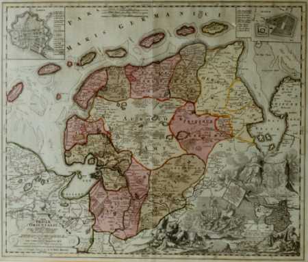 "Tabula / FRISIAE / ORIENTALIS / olim / Ubbonis Emmii [...]", Ehrenreich Gerhard Coldewey, 1730. |
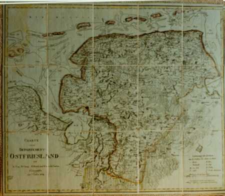
"CHARTE / vom / DEPARTEMENT / OSTFRIESLAND [...]", |
|
For further information i have put together: Selected Websites and literature on the subject old maps (of East Frisia). If you are also interested in old maps of East Frisia I would also be very pleased about an entry into the guestbook. Back to the starting page of Michael ReckeÇs Homepage.
|
|
|
Wechseln Sie zur deutschen Version dieser Seiten!
|
since 08-22-1997. |
US-American-East Frisian
|